

I spent thirty-one years in local government, and if there is one thing that gets my goat, it’s the idea that you need a high-priced consultant or a degree in urban planning to understand your own backyard. People often think that learning how to research a local estate requires digging through expensive, locked archives or hiring a professional surveyor just to see who owns what. That is a complete myth designed to keep small community groups feeling small. I’ve seen too many wonderful neighborhood projects stall out simply because the organizers felt intimidated by the perceived complexity of the paperwork.
I’m not here to give you a lecture or a list of academic theories that won’t work in the real world. Instead, I am going to show you how a small, organized committee can practically uncover the history and ownership of your street using nothing more than a bit of grit and the right public records. I will walk you through the exact, no-nonsense steps I used during my years in regeneration to find the facts. My goal is to give you the tools to build a foundation of truth, so your group can stop guessing and start making actual changes.
The Paper Trail How to Research a Local Estate

You don’t need a degree in archaeology to start uncovering the history of your street, but you do need a bit of patience and a sturdy folder for your notes. I always tell my neighbors that the most important tool isn’t a shovel; it’s a land registry search. It might sound a bit formal, but it’s the most straightforward way to see who actually holds the keys to the land you’re standing on. Once you have those basic property ownership records in hand, you start to see the patterns—the way a single family might have held a corner lot for fifty years, or how a small strip of land was carved out for a public footpath that everyone seems to have forgotten.
If the registry feels a bit dry, I suggest heading down to the library or the town hall to dig through the local council planning records. This is where the real stories live. You’ll find the old blueprints, the rejected extensions, and the notes on why a certain park was built or why a row of houses was demolished. It’s much more rewarding than just looking at a modern map; it’s about seeing the intent behind the layout of your community.
Unlocking Secrets Through Public Land Records Access
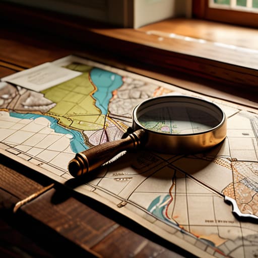
Once you’ve got your small group together, the next step is to look at who actually holds the cards. Most people assume the local council owns everything, but that’s rarely the case. You’ll need to conduct a formal land registry search to see where the lines are actually drawn. It’s a bit of a chore, I know, but knowing whether a patch of grass is public or private is the difference between a successful community garden and a very awkward conversation with a bailiff.
Don’t stop at the modern maps, either. If you want to understand why a certain boundary looks so odd, you have to dig into the local council planning records. I’ve spent many an afternoon in dusty basement archives looking at old building permits; they tell a story that a modern digital map simply can’t. You might find that a disputed alleyway was actually intended for public access back in the 1950s. Documenting these small details is how you build a case that local officials can’t simply brush aside.
The Land Registry Search Mapping Every Change
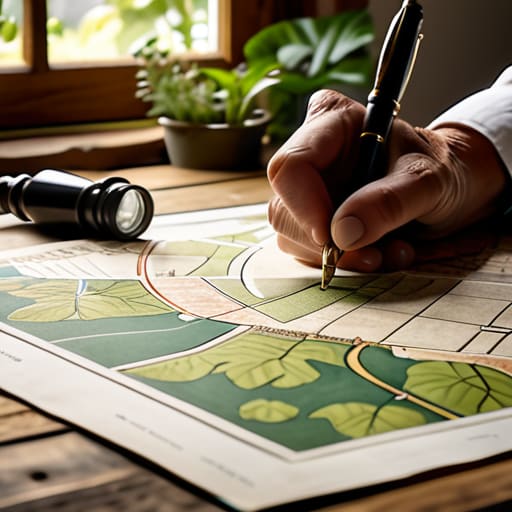
Now, if you want to see who actually holds the cards, you have to move beyond the dusty archives and look at the modern legal reality. This is where a formal land registry search becomes your best friend. It isn’t just about seeing who lives behind a certain front door today; it’s about understanding the legal boundaries that dictate what can and cannot happen on your street. I’ve seen so many lovely community garden projects stall simply because a group didn’t realize a tiny sliver of land was actually privately held. You don’t want to be caught out halfway through a fundraiser.
When you pull these official documents, you aren’t just looking at names; you are looking at the legal backbone of your neighborhood. By examining these property ownership records, you can spot patterns—perhaps a single landlord owns half the terrace, or a long-standing trust holds the rights to that patch of grass everyone uses. Having this clarity is vital. Once you know exactly where the lines are drawn, your committee can stop guessing and start making informed, strategic decisions about your next big move.
Tracing Ancestral Land Holdings via Historical Documentation
Now, if you want to see the real soul of a street, you have to look past the current fences and into the old maps. I’ve spent many an afternoon in dusty archives, and I can tell you that tracing ancestral land holdings isn’t just for genealogists; it’s for anyone who wants to understand why a certain patch of ground is shaped the way it is. You’ll often find that what looks like a random alleyway today was once a vital thoroughfare or a shared garden for a group of workers.
To do this properly, you need to dig into the historical estate documentation held at your local county archives. I always suggest looking for old tithe maps or estate papers; they tell a story that modern digital files simply miss. You might discover that a piece of land was once held by a single family or, more interestingly, managed by a small trust. Finding these old connections can give your committee the historical leverage you need to argue for better community use of a space. It’s about finding the original intent of the land.
Deciphering Property Ownership Records and Hidden Intent
Once you’ve gathered your documents, the real work begins: making sense of them. It isn’t enough to just see a name on a page; you have to understand why that name is there. When I look through property ownership records, I’m not just looking for a list of owners, but for the patterns they left behind. Was a plot sold off in pieces during a period of economic slump? Did a single family hold onto a large parcel for decades before a developer swooped in? These aren’t just dry facts; they are the fingerprints of how our neighborhood was shaped.
You’ll often find that the most telling clues aren’t in the deeds themselves, but in the local council planning records. I’ve spent many afternoons cross-referencing old maps with planning applications to see where a garden ended and a commercial unit began. If you see a sudden flurry of small-scale changes, it usually signals a shift in the street’s character. Don’t just skim the surface; look for the gaps between the entries. Those silences often tell you exactly where the old community boundaries used to sit.
Local Council Planning Records Where Progress Meets History
Now, if you want to see where the actual “friction” in a neighborhood comes from, you have to look at the local council planning records. While a land registry search tells you who owns the dirt, the planning office tells you what they intended to do with it. I spent decades in local government, and I can tell you that the most interesting stories aren’t in the deeds, but in the rejected applications and the long-forgotten building permits. You’ll often find that a street’s current character was shaped by a single, contentious decision made forty years ago.
I always suggest digging into the planning archives specifically for “change of use” applications. This is where you find out why that lovely old corner shop became a derelict garage or why a certain patch of green was paved over. It’s more than just bureaucracy; it’s the blueprint of how your community evolved. When you combine these files with your historical estate documentation, you start to see the patterns of why certain areas flourished while others were left behind. It’s the difference between knowing a house exists and understanding why it looks the way it does.
Five Practical Ways to Keep Your Research Moving Forward
- Don’t go it alone; find a local history buff or a retired clerk who remembers the old ways, because they often know which filing cabinets actually hold the good stuff.
- Keep a dedicated notebook specifically for your findings, because if you don’t write down which archive gave you which document, you’ll spend three weeks retracing your steps.
- Always ask for the “context” of a document, not just the date, because a map from 1950 tells a very different story if you know there was a major rezoning vote the month before.
- Budget a small amount of “research cash” in your group account for official search fees, so you aren’t scrambling for coins every time you need a certified copy from the Land Registry.
- Verify everything with two different sources, because a single old map can be wrong, but a map matched against a census record is almost certainly the truth.
## The Value of the Paper Trail
“Don’t let the dusty folders and official jargon intimidate you; those records aren’t just bureaucracy, they’re the map of your neighborhood’s soul. If you want to know why a street looks the way it does, or who actually holds the keys to its future, you have to be willing to sit down with the archives and learn to read between the lines.”
Deborah Castellanos
The Map is in Your Hands
Looking back at everything we’ve covered, it’s clear that researching an estate isn’t just about staring at dusty maps or clicking through the Land Registry. It’s about connecting the dots between the planning permissions at the council, the old family holdings in the archives, and the actual physical boundaries of your street. You’ve moved from guessing to knowing. By following this paper trail—from the historical documents to the modern ownership records—you are building a foundation of facts that no one can dismiss. You aren’t just looking at dirt and bricks; you are uncovering the true DNA of your neighborhood.
I’ve seen too many good community projects stumble simply because the people in charge didn’t know where they stood legally or historically. Don’t let that be your group. Now that you have the information, the real work begins. Take those records, bring them to your next committee meeting, and use them to decide your next move. Whether you are fighting a planning application or starting a community garden, you are doing it with your eyes wide open. Remember, a well-informed group is a formidable force, and with this knowledge, you are finally ready to make your mark.
