
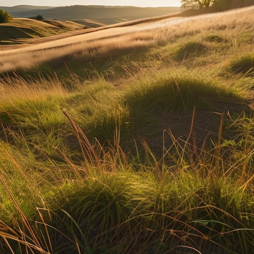
I remember standing on the edge of a damp meadow in North Yorkshire, clutching a clipboard and feeling completely foolish because I was looking for something that wasn’t there. Everyone tells you that you need expensive ground-penetrating radar or a PhD in soil stratigraphy to understand what lies beneath your feet, but that is a load of rubbish. If you want to learn how to spot archaeology in a field, you don’t need a fancy sensor; you need to stop staring at the dirt and start looking at how the land is shaped. It’s about spotting the patterns people left behind, the subtle dips and ridges that don’t quite make sense to the untrained eye.
I’ve spent thirty years in local government seeing community projects crumble because people focused on the wrong details, and I won’t let that happen here. I am not going to give you a lecture full of academic jargon that leaves you more confused than when you started. Instead, I am going to show you the practical, boots-on-the-ground methods I’ve used to identify historical footprints. I’ll teach you how to read the landscape like a map, ensuring you know exactly what you’re looking at before you even pick up a spade.
The Ground Is Speaking How to Spot Archaeology in a Field

You don’t need a degree in archaeology to see that something isn’t quite right with a piece of land; you just need to learn how to read the subtle shifts in the scenery. Most people walk right over history, but if you stop and look at the way the grass grows, the story begins to emerge. I’ve found that the most reliable way of identifying subsurface features isn’t by digging immediately, but by watching how the moisture sits in the earth. A patch of ground that stays damp long after a rain, or conversely, a spot that dries out much faster than the rest of the meadow, is often telling you that something is sitting just beneath the surface.
Often, these clues manifest as soil discoloration patterns that break the natural flow of the field. You might see a faint, dark line cutting across a slope where there shouldn’t be one, or a slight mound that looks more intentional than a simple hillock. These aren’t just oddities; they are the landscape’s way of pointing toward detecting buried structures like old foundations or ancient boundary ditches. It’s about noticing the breaks in the pattern.
Reading the Earth Deciphering Subtle Soil Discoloration Patterns
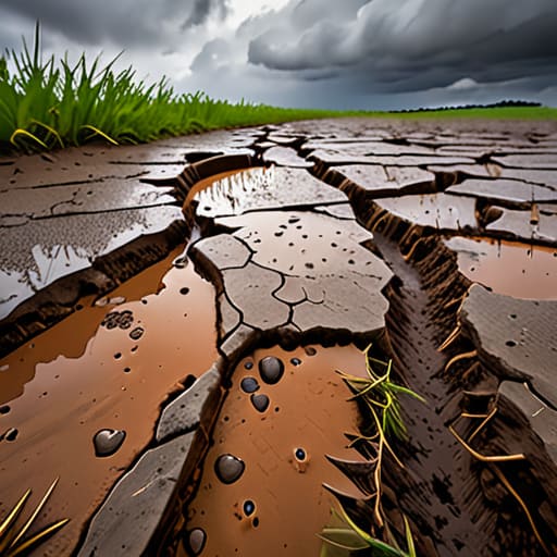
Now, if you’re standing in a field after a heavy rain, don’t just look at the grass; look at the colour of the mud. This is where the real work of identifying subsurface features begins. When an old wall or a pit has been filled in for centuries, the soil there holds moisture differently than the undisturbed ground around it. You might see a patch of earth that looks darker, almost bruised, or perhaps a lighter, sandy streak cutting through the heavy clay. These soil discoloration patterns aren’t just random blemishes; they are often the only physical evidence left of something that was once very much alive and functional.
I’ve learned through years of looking at old maps that these shifts in hue are rarely accidental. A dark, irregular smudge might indicate a former hearth or a midden, while a straight, pale line could be the ghost of a drainage ditch. It takes a bit of patience to sit with the land, but once you start detecting buried structures through these subtle shifts, the field stops being just a flat expanse of green and starts telling you its history.
Eyes in the Sky Mastering Aerial Archaeology Techniques
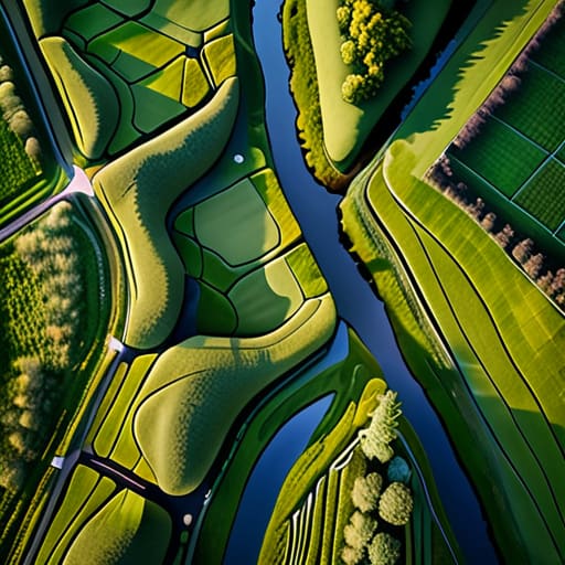
Now, don’t let the name fool you; you don’t necessarily need a helicopter or a pilot’s license to get the benefit of a bird’s-eye view. In my years working on regeneration projects, I learned that sometimes you simply cannot see the forest for the trees—or in this case, the village for the hedges. When we look at the ground from eye level, we get caught up in the immediate details, but looking from above allows you to see the broader landscape archaeology indicators that dictate how a community actually moved through a space.
Even a simple drone or a well-timed photograph taken from a high ridge can be a game-changer for identifying subsurface features. You aren’t looking for ruins or broken pottery from the air; you are looking for the way the light hits the grass. A subtle dip in the field or a patch of crop that looks slightly more parched than the rest often signals something hidden beneath. These aerial archaeology techniques turn the entire field into a map, revealing the ghostly outlines of long-gone walls or ancient pathways that are completely invisible once you’re standing right on top of them.
Invisible Walls Identifying Subsurface Features Beneath Your Feet
Sometimes, you’ll be standing in a field and feel a strange sense of geometry that doesn’t quite match the natural slope of the land. This is where the real work begins. You aren’t just looking at a surface; you are identifying subsurface features that have been tucked away for centuries. I often think of it like reading a faded ledger—the entries are still there, but you have to know how to squint to see the ink. If you notice a sudden, sharp change in the way the grass grows, or perhaps a line of slightly more parched earth cutting across a damp meadow, you might be looking at the ghost of a foundation or a collapsed boundary ditch.
It is easy to get distracted by the obvious things, but the most significant landscape archaeology indicators are often the quietest. You might find a subtle ridge that seems out of place, or a slight depression that suggests where a wall once stood. These are the footprints of people who lived, worked, and organized themselves long before we arrived. By paying attention to these small shifts in the earth, you aren’t just looking at dirt; you are detecting buried structures that tell the true story of how a community once took shape.
The Landscapes Memory Landscape Archaeology Indicators to Watch
You have to stop thinking about a field as just a patch of grass and start seeing it as a long, continuous conversation. When I was working in regeneration, I learned that nothing happens in a vacuum; a new community centre is usually built because of where the old paths used to run. The same applies here. You aren’t just looking for a single object; you are looking for landscape archaeology indicators that suggest how people moved across the terrain. Look for those strangely straight hedge lines or sudden changes in the slope of a hill. These aren’t accidents of nature; they are often the ghost-prints of ancient boundaries or old trackways that have been swallowed by time.
Sometimes, the most telling signs aren’t even in the soil itself, but in how the surrounding environment reacts to what lies beneath. You might notice a particular patch of woodland that grows more vigorously than the rest, or a dip in the land that holds water differently than its neighbours. This is often a result of detecting buried structures through the way they affect the local ecology. It’s about seeing the pattern of the whole area rather than getting lost in the weeds.
Unearthing Secrets Detecting Buried Structures Before the Shovel Hits
Now, I’ve seen many a well-meaning volunteer arrive on site with a spade in hand, ready to dig, only to realize they’ve missed the most important part: the preparation. You see, detecting buried structures isn’t actually about the act of digging; it’s about the patience of looking. Before you ever break the surface, you have to understand that the ground is a layered archive. If you rush in, you risk destroying the very context that tells us why a building was there in the first place.
I always tell my committee members that we need to treat the field like a giant, half-finished puzzle. You aren’t just looking for walls; you’re looking for the subtle tells that suggest something solid lies beneath. This is where identifying subsurface features becomes an art form rather than a science. You have to look for those tiny, unnatural shifts in the way the grass grows or how the ground holds moisture. If you can learn to read those quiet signals first, you won’t just be digging holes—you’ll be uncovering history with purpose.
Five Things I’ve Learned About Reading the Land
- Stop looking for grand ruins and start looking for the oddities; if a patch of grass is a shade greener or a bit more stunted than the rest, it’s usually because something is sitting just beneath the surface.
- Watch the way the light hits the ground at sunrise or sunset—long shadows will catch the slightest dip or swell in the earth that you’d miss in the flat glare of midday.
- Keep an eye on the vegetation, because plants are the best historians we have; certain weeds or wildflowers love the disturbed soil of an old ditch or the nutrient-rich remains of a long-gone hearth.
- Don’t ignore the field boundaries, because people rarely change a path or a hedge line without a very good, very old reason.
- Trust your feet more than your eyes; a sudden change in the firmness of the ground or a slight, rhythmic bump under your boots often tells a truer story than a photograph ever could.
## The Pattern in the Patchwork
“You won’t find history by staring at a single clod of earth; you find it by looking at the way the field refuses to be uniform—those slight dips, those odd patches of greener grass, and those lines that don’t quite follow the plough. It’s not about finding something broken; it’s about noticing where the land is remembering something it wasn’t supposed to keep.”
Deborah Castellanos
A Final Look at the Layers
When you step out into a field, you aren’t just looking at grass and soil; you are looking at a living record. We’ve talked about everything from those subtle shifts in soil colour and the way crops grow differently over buried walls, to the way a bird’s-eye view can reveal patterns the human eye misses at ground level. It really comes down to learning how to see rather than just looking. Whether it’s a slight dip in the land or a peculiar discoloration in the earth, these clues are the fingerprints of people who stood exactly where you are standing hundreds, perhaps even thousands, of years ago. If you take the time to study the patterns instead of rushing to the finish line, the landscape will eventually start to tell you its story.
I often think about my old committee minutes—how so much history is lost simply because no one bothered to record the small details. Archaeology is much the same. The history of our communities isn’t always found in grand monuments; it’s often tucked away in the quiet, overlooked corners of a meadow. My advice is to approach every field with a bit of patient curiosity. Don’t feel you need a PhD to notice something is “off” about a patch of ground. Just keep your eyes open, stay observant, and remember that the earth never truly forgets; it just waits for someone with enough patience to listen.
