
I remember sitting in a drafty community hall back in ’98, surrounded by thirty shouting neighbors, all of us arguing about where a new playground should actually go. We were looking at blurry, printed maps that showed nothing but grey lines, and frankly, we were wasting our breath. People will try to tell you that you need a massive budget or a degree in urban planning to understand how to use aerial photographs to make a case for change, but that’s just nonsense designed to keep small groups feeling small. You don’t need a high-priced consultant; you just need a clear view of the ground you’re actually standing on.
I’m not here to give you a lecture on satellite technology or complex software. Instead, I want to show you how a small, organized committee can use these images to prove a point to the council. I’ll walk you through the practical, no-nonsense ways to gather these visuals, how to print them so everyone can actually see the details, and how to use them to map out your goals before you ever pick up a shovel.
The View From Above How to Use Aerial Photographs to Reclaim Your Street

When I was working in local government, I saw so many well-meaning community projects stumble because they were fighting a battle against a landscape they didn’t fully understand. You can’t fix a street if you only see it from the pavement. I always tell my committees: you need to see the bigger picture before you start digging. By looking at high-resolution shots from above, you can spot the gaps in the greenery or the exact spots where drainage seems to be failing. It’s not just about pretty pictures; it’s about geospatial data interpretation used in a way that actually makes sense to a group of neighbours.
Sometimes, the most important thing isn’t what is there now, but what used to be there. I’ve found that performing a historical aerial imagery comparison can be a real eye-opener for a small group. You might discover that a particular patch of overgrown scrub was once a communal garden or a vital footpath. When you can show a council a map that proves how a space has changed over fifty years, you aren’t just complaining—you are presenting a case. It turns a vague wish into a documented plan of action.
Mapping the Hidden Mastering Remote Sensing Techniques for Local Change

Now, don’t let the technical jargon intimidate you. When I talk about using remote sensing techniques, I’m not suggesting you need a degree from an engineering faculty; I’m saying you need to look closer than the naked eye allows. If your committee is trying to figure out why a particular patch of ground always stays boggy or why a certain boundary seems to shift, you can use these tools to see patterns in the soil or vegetation. It’s about reading the land like a map that’s been partially erased.
I often find that the most powerful tool in our kit is historical aerial imagery comparison. I’ve spent many an afternoon in the archives looking at photos from the 1950s to see where old hedgerows used to sit or where a forgotten footpath once ran. By layering these old views against what we see today, we can perform a bit of informal landscape evolution analysis. It helps us understand the true bones of our neighbourhood, ensuring that when we propose a new community garden or a paved walkway, we aren’t fighting against a hundred years of established geography.
Seeing Through Time Historical Aerial Imagery Comparison for Community Root
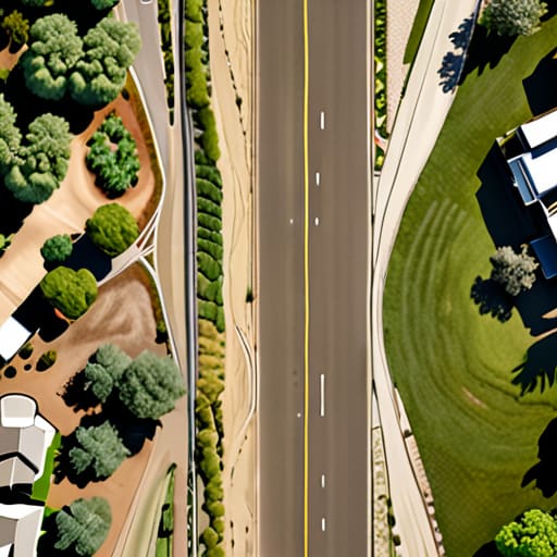
There is a particular kind of magic in looking at a map from 1950 and comparing it to a satellite shot from last Tuesday. I spent years in local government watching people argue over where a new community garden should sit, often because they forgot what used to be there. By using historical aerial imagery comparison, you aren’t just looking at pictures; you are performing a bit of landscape evolution analysis that tells you exactly how the ground has shifted under your feet.
If you want to prove to the council that a patch of wasteland was once a vital green corridor, you need that visual evidence. It’s much harder for a planning committee to dismiss your proposal when you can show them—on a large, printed scale—exactly how the character of the street has eroded over the decades. Sometimes, these old photos even help with archaeological site identification, revealing old boundary lines or forgotten footpaths that still dictate how people move through the neighbourhood today. Don’t just guess what your street used to be; find the proof in the archives and use it to build your case.
The Ground Beneath Us Landscape Evolution Analysis for Neighborhood Growth
It is one thing to look at a map and see where things are, but it is quite another to understand how they got that way. When I was working in regeneration, I learned that a street isn’t just a collection of bricks; it is a living thing that changes shape over decades. By using landscape evolution analysis, your small committee can move beyond just seeing a vacant lot and start seeing the patterns of how land has been used, drained, or built upon over time. It helps you predict where a new community garden might struggle with soil issues or where a paved area might actually be an old, forgotten footpath.
You don’t need a degree in geography to get started, but you do need a bit of patience for geospatial data interpretation. If you can layer modern shots over older ones, you’ll start to see the “ghosts” of previous layouts. This isn’t just for historians; it’s practical for us. Understanding these shifts allows us to plan for growth that actually fits the neighborhood’s bones, rather than fighting against them. It’s about making sure our small projects are built on a foundation that makes sense for the long haul.
Unearthing the Past Archaeological Site Identification for Every Block
Now, don’t get me wrong—I’m not suggesting we all go out there with brushes and trowels like we’re on a television programme. But sometimes, the most important thing a small committee can do is figure out what is actually sitting beneath our feet before we start digging up a community garden or a new play area. Through careful archaeological site identification, we can spot the subtle outlines of old foundations or ancient field boundaries that aren’t visible from the pavement.
It’s often about looking for those slight depressions or “crop marks” in the grass that only show up when you look at a high-resolution image from above. By using a bit of geospatial data interpretation, we can see patterns that the naked eye misses during a Sunday stroll. It’s not just about finding old pots; it’s about respecting the layers of history that make our neighbourhood what it is. If we know where the old settlement lines were, we can plan our improvements in a way that honours the past rather than accidentally bulldozing it.
Turning Pixels Into Power Geospatial Data Interpretation for Six People
Now, don’t let the word “geospatial” intimidate you. It sounds like something out of a high-level government briefing, but for our purposes, it’s just a fancy way of saying we are looking at the relationship between what we see in a picture and what is actually happening on the pavement. When I was working in local government, I saw so many lovely projects stall because the committee couldn’t agree on where a new planter should go. By using geospatial data interpretation, we take the guesswork out of the equation. Instead of arguing in a drafty community hall, we look at the data to see exactly where the sunlight hits or where the drainage is failing.
You don’t need a degree in mapping to make this work. If you have a small group, assign one person to be the “data keeper.” Their job isn’t to do complex math, but to translate those images into a simple, actionable list for the rest of the committee. Whether you are using photogrammetry in archaeology to spot an old boundary line or just measuring the width of a curb, the goal is the same: turning information into a plan of action. If we can see it clearly, we can fund it, and if we can fund it, we can build it.
Five Ways to Turn Those Pictures into Real Progress
- Don’t just look at the pretty colors; use the images to spot the gaps. I’ve seen more community projects fail because they missed a patch of neglected green space that was staring them right in the face from a bird’s-eye view.
- Print them out large and get them on a physical table. You can’t build a consensus around a tiny laptop screen; people need to lean over a big map, point their fingers, and actually see where the new benches or planters should go.
- Cross-reference your photos with the local council’s planning maps. It saves a lot of heartache—and a lot of wasted committee meetings—if you realize the “empty lot” you were planning to garden is actually slated for a new drainage pipe.
- Use the imagery to tell a story to the bank. When you’re applying for a small community grant, showing a “before and after” comparison of a derelict corner makes your case much harder to ignore than just a written plea.
- Keep a folder of every aerial shot you use. I’ve learned the hard way that if you don’t document exactly what the street looked like when you started, you’ll have no way to prove to the neighbors how much you’ve actually achieved.
## From Pixels to Policy
“Don’t get lost in the high-tech jargon; an aerial photo isn’t just a pretty picture of the rooftops. It’s a map of your potential. When you can show a council member exactly where the green space has dwindled or where the drainage is failing, you aren’t just complaining anymore—you’re presenting a case they can’t ignore.”
Deborah Castellanos
From Pixels to Pavements
We have covered a lot of ground today, moving from the broad, sweeping views of modern aerial shots to the delicate work of spotting historical layers and archaeological traces beneath our feet. It can feel a bit overwhelming when you first look at a map and see nothing but a jumble of shapes and colors, but remember that these images are simply tools. Whether you are using remote sensing to find where a new community garden might thrive or comparing old photographs to understand why a certain corner feels so disconnected, you are essentially building a visual argument. Once you have gathered this data, you aren’t just a group of neighbours with a hobby; you are a committee with unshakeable evidence to present to the council.
At the end of the day, a photograph is just paper or a screen until you do something with it. I have seen too many wonderful ideas wither away simply because the people involved couldn’t quite articulate the “why” or the “where” of their vision. Don’t let that be your story. Take these maps, sit down with your five fellow committee members, and start planning. You have the perspective, you have the history, and most importantly, you have the blueprint for change. Now, go out there and make it happen.
